The bottom of the river
BY ALYSSA MEIER
Editor
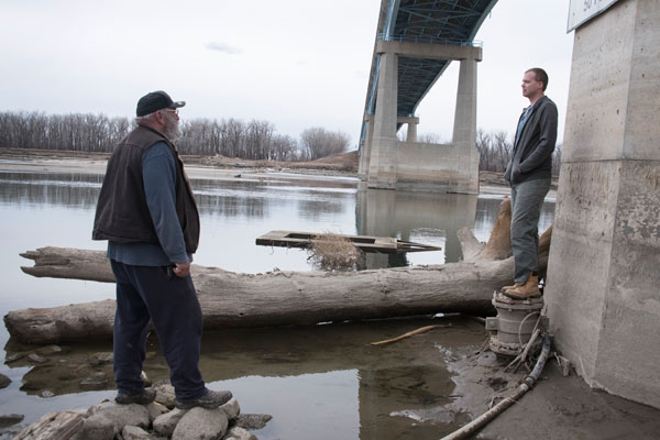
The two men walked across the water-logged sand, eyeing the exposed pipelines sitting a few inches above the water’s surface.
“It should be up to our waists right here,” Public Works Superintendent Bryan Rothman said as he walked the riverbottom a few yards away from Washburn’s water intake, which was covered by less than a foot of water Tuesday afternoon.
The concrete around the intake peered out above the surface of the river, which was only a few feet deep in some areas. Some less than that.
“You could easily walk to that sandbar,” Water System Supervisor Adam Thomas said.
As of Tuesday afternoon, the river was just over eight feet deep at Washburn, according to the U.S. Geological Survey. On the same day last year, the river was at 11.5 feet deep.
The river has dropped dramatically in the last two months, down from nearly 17 feet deep in February. It has remained steady for the past couple of weeks, but that could change if releases up-river are decreased.